Ads

Showing posts with label outdoors. Show all posts

After 10 minutes of driving from the beach (it probably wouldn’t take more than an hour to drive around the entire island), we reached Vesuvius. We didn’t know the name of the restaurant, but from the institutions in the “town”, Seaside Restaurant was probably the only place to grab a bite. Oysters, fish and chips (halibut), and clam chowder:

fresh

Tasted extra good, after all the fails with the clams. The chowder had huge chunks of clam, the fish was fresh and had good meat to batter ratio, and we were ready to keep going. For a little place on a tiny island, the food was better than good. If they set up shop on the mainland, I might go again, but it’s still not worth the 3 hour ferry ride.
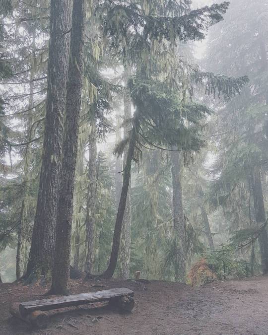
Seaside Restaurant Menu, Reviews, Photos, Location and Info - Zomato

1:00PM: Mt. Erskine
SONY

other hikers

fairies?

Trail is a bit steep, but the fairy doors are worth it.

More info on this trail: https://saltspringmarket.com/hiking-on-salt-spring-island/mt-erskine-from-juniper/

Side note: S8 came out today. I dropped my S7 from the seat of H’s 4Runner (now known as Big Bertha), while I was getting out of the car, and it tumbled to hard cement ground. A couple side scratches, no cracks. Faith restored in Samsung.


Return to Day 1 on Salt Spring
Go to Day 2 on Salt Spring
I’m very glad that the work crew dragged me out to this hike, needed to escape, runaway and hide in the fog for a day. Recharged and ready to go for the next week! (This doesn’t always last very long, I usually crash by mid week and am ready to runaway again).


A rest area after the switchbacks.

Lesser Lake comes first, poor thing gets a put down name.

Walk faster guys…


IMG_20161006_222052
First views of the lake.

So calm.

IMG_20161006_221111
Sneaky shot of somebody meditating.

Around to the other side of the lake.


IMG-20160925-WA0021
Time to go home. Photo credits – PvN


Hiking boots are a huge plus, it’s getting muddy up there. Make sure to carry enough water and food, but not too much. I don't recall how crowded it was last time that I visited, which was probably about 3 years ago, at least. It's still not too bad. I think the wet ground and the switchbacks keep people away.

More on this hike here:
https://www.vancouvertrails.com/trails/garibaldi-lake/
https://www.livetrails.com/trails/Garibaldi-Lake-19.html
http://whistlerhiatus.com/whistlerhikes/garibaldi-lake.html

My photo style keeps switching with my mood… That soft foggy look is so moody, and the clear almost HDR look brightens up the page. Either way. Hope to squeeze in more hikes before snow season.

We were planning to get to the parking lot at Cypress by 7AM to hike 5hrs, 11km, to St. Mark’s Summit, which is a part of the Howe Sound Crest Trail, but we ended up leaving the McDonalds by Boundary and Lougheed at around 730AM. After a hearty meal of Sausage Egg McMuffin and hashbrowns, purchased using the coupons available on their mobile app, we were ready to hike.

IMG_20150907_152850

The view from the top was spectacular, with a few low hanging clouds. This was from the 2nd farther viewpoint after reaching the summit (takes a bit of searching to find the correct path to get here… go around!). Snacks for this hike included a 6 plums from the tree in my backyard and a 90 calorie fibre1 chocolate chip cookie, split between the 4 of us…

IMG_20150907_202908

Things to note if doing this trail next year at this time…

-It’s wet and muddy up there at this time and it was drizzling a bit this morning. Wear hiking boots, bring a jacket.
-There were no ravens this time.
-Go earlier as this trail is becoming more popular.

IMG_20150907_203342

IMG_20150907_203845

More info at Vancouver Trails: http://www.vancouvertrails.com/trails/st-mark's-summit/

What’s an intermediate hike with a view near Vancouver that isn’t congested?

IMG_20150901_234612 IMG_20150901_234311 IMG_20150823_152940
Last last last weekend, we did an easy local hike. A good 5 hour hike at an easy pace, lots of stairs, pretty well groomed and well marked path. H was dehydrated and cramped pretty hardcore (sucker, who told you to drink the night before?). The trail head at Lynn Canyon was packed with people and the trail end at Quarry Rock/Deep Cove was like walking around downtown. The middle of the trail had less traffic. Mostly mountain bikers in the middle of the trail. A few of them passed us while we sat down for a few snacks…
IMG_20150828_075912
This Munk Pack Oatmeal Fruit Squeeze (Blueberry Acai Flax flavor) was actually quite delicious. H got it for as a sample in his Cairn box, but I think I would definitely get it again for the next camping or hiking trip.
Here’s more info on the trail at Vancouver Trails (pretty damn awesome website…): http://www.vancouvertrails.com/trails/baden-powell-deep-cove-to-lynn-canyon/


Note: Photos were all edited with Instagram! I like that Gingham filter.